Description
Super Interactive Maps for WordPress
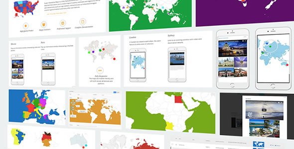
Super Interactive Maps is a fully-featured WordPress Plugin integrated with Google Geochart API that allows you to create maps of country, continent and regions. Create custom markers on top of your map to show location of interest such as hotel, cafes, airport and others. You can add interactivity to your map such as displaying interactive tooltips, lightbox window or linking to a web page content.
This is a responsive plugin and fully compatible with the latest WordPress version and Visual Composer.
Main Features
- Includes over 300 maps all in a one plugin
- All 195 countries world-wide included
- Easily create SVG and vector maps on your WordPress site
- Fully responsive and works on all mobile devices (cross device and browser compatible)
- Vector Maps of World Map, Continent or Subcontinent including Africa, Europe, Asia, Oceania, Africa, South America, and Americas
- Vector Maps of India, China, Turkey, Romania, Japan, Spain, Italy, France, Canada, Germany, UAE, Syria, Iceland, Poland, Malaysia, Australia, Mexico, Brazil, Indonesia, Nepal, UK, US, Russia and all countries included
- Vector Maps of all countries divided by regions
- Autocomplete Search to easily add locations
- Pin point to the exact location using the drag and drop marker feature (Admin integrated with Google Maps API)
- Customizable map designs, styles and colors
- Choose your display styles (Regions, Markers or Text Labels)
- Interactive responsive lightbox popup to showcase rich content such as text, images and videos
- Add and customize interactive tooltips to maps
- Zoom and Pan your map display
- Display custom map markers on your map
- Post shortcodes anywhere on your website including posts, pages and sidebar widgets
Features Highlight
Create Beautiful SVG and Vector Maps
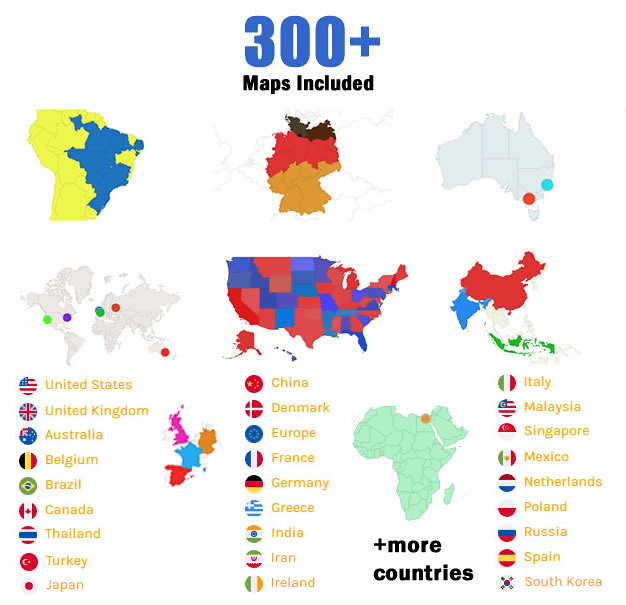
Supported Maps:
- World Maps
- All Continent and Sub-continent including Africa, Europe, Americas, Asia and Oceania.
- All Counties (All 195 countries in the world including USA, Brazil, United Kingdom, Australia, Canada, France, Germany Spain, Italy, Turkey, Singapore, Brazil, Chile, China, Japan, India, many more)
- All Countries divided by regions
- USA maps divided by state/region/city areas
The maps design, styles and colors are fully customizable.
Fully Responsive and Supports Multiple Devices and Browsers Compatibility
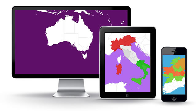
The interactive maps including the rich content (i.e pop ups, videos, images, etc) will be fully responsive and works across all device and browser compatible.
Multiple Display Styles (Regions, Markers and Text Labels)
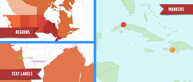
You can choose to add 3 types of display styles for your maps which are Regions, Markers and Text Labels.
Map Interactivity – Tooltips, Pop up, JavaScript and Link to URL
You can add tooltip, interactive pop up and add a links to urls on your map.
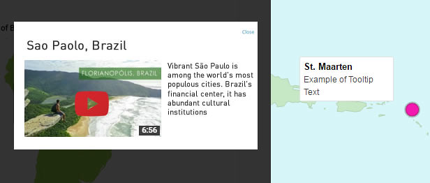
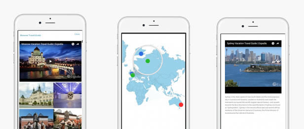
The interactive pop up that showcases your rich content such as text, images and videos works perfectly on mobile device.
Custom Map Markers
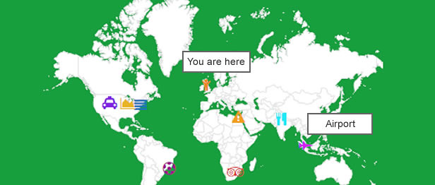
You can add map markers using icons from font-awesome for your map.
Publish Anywhere on Your Website (Posts, Pages and Widgets)
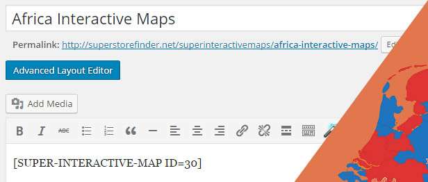
Publish your maps anywhere on your website using shortcodes which can be used on posts, pages and sidebar widgets.
Fully Customizable Maps
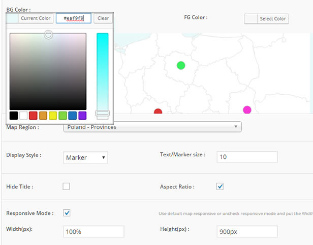
You can customize your maps visually as below:
- Background Color
- Border & Border Hover Color
- Foreground Color
- Map Hover Color
- Zoom and Pan Levels
- Region Colors
- Marker Colors
- Marker Size
- Text Label Colors
- Custom Markers
- Width and Height of Map
Zoom and Pan Your Map Display
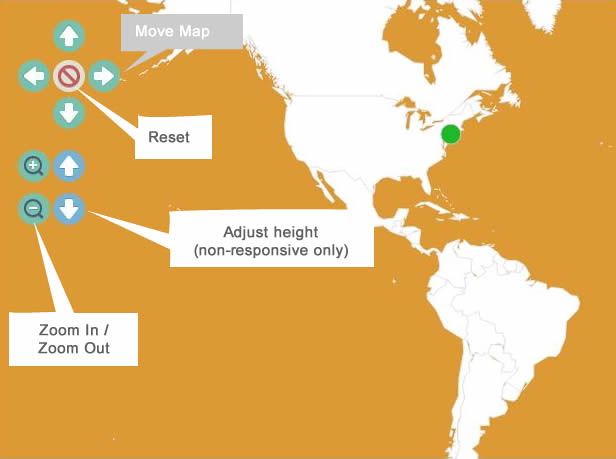
You can zoom in / out and crop your map to display the map on your website the way you want.
Powerful Administrator
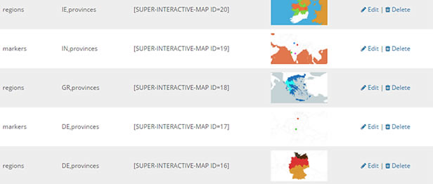
Create and manage your maps using the powerful administrator. The administrator is equipped with Autocomplete search feature and integrated with Google Maps API to allow you to search locations via Google Maps and use drag and drop marker to pin point to the exact location.
Autocomplete Search Feature for Extra Convenience
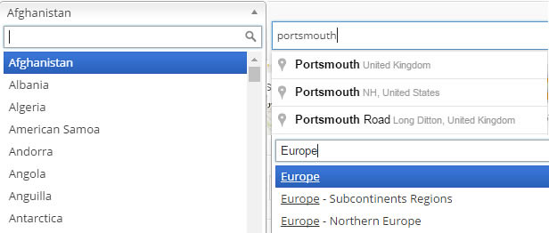
Search locations easily using Google Autocomplete feature. In addition, you can search for World Regions and Map Display options with ease using the the suggestive autocomplete search.
Drag and Drop Marker Feature (Pin point exact location)
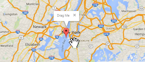
Integrated with Google Maps, it allows you to drag and drop marker to pin point to the exact location while creating maps using the administrator.
Real world usage examples
This plugin can be used for:
- Blog Posts – You can display a map with tooltip and interactivity to show a particular location in the world
- Travelling Websites – Awesome to showcase destinations and include rich media content to engage visitors
- Corporate – Showcase branches around the world
- Store Locator – Can showcase your store or office locations. Able to be integrated with Super Store Finder – Learn more
- Wiki Sites – Really informative for Wiki and information sites to showcase locations.
- Infographics – Display informative interactive maps to engage with users
- And many other creative use.
What are buyers saying about Super Store Finder
“Great customer support in time of need!”
—sbigley
“Great plug-in, works perfectly, also excellent and speedy customer support.”
—HBHQ
You can find more reviews from real buyers in testimonials page.
Fast and Reliable Support
We provide fast and reliable support to our customers, whether its an inquiry, troubleshooting, customization and special requests. If you need help with installation, just send us a message via our profile page here.
For knowledge base and forums you can visit the following links:


You can visit http://superstorefinder.net/support and also follow us on envato for new releases and products here
Follow our latest updates and videos on


Patch Notes
2.2 (Last updated: 9 Mar 2020)
- Fixed SQL Injection related to minor search query
2.1 (Last updated: 16 Feb 2021)
- Fixed jQuery panzoom compatibility with WordPress 5.6
2.0 (Last updated: 12 Dec 2020)
- Fixed plugin Vulnerability post Penetration Test
1.9 (Last updated: 7 Oct 2020)
- Fixed missing map on add / edit map due to Google GeoChart API updates (MAJOR UPDATE) (Patch Details)
- Update compatibility with Visual Composer
1.8 (Last updated: 29 Apr 2020)
- Added zoom feature for frontend map using CSS (Patch Details)
- Added HTML tooltip settings at admin settings page
1.7 (Last updated: 5 Sep 2019)
- Fixed compatibility with WordPress Gutenberg Editor
1.6 (Last updated: 9 Apr 2018)
- Added border and border hover settings at admin settings page
1.5 (Last updated: 30 Dec 2017)
- Link existing Google API key when generating interactive maps
1.4 (Last updated: 12 Nov 2017)
- Added duplicate/copy map feature
1.3 (Last updated: 3 Jan 2017)
- Fixed compatibility with WP Google Analytics Events
- Added multiple roles settings at admin
- Added more regions and provinces
1.2 (Last updated: 28 June 2016)
- Added Google Maps API key at settings page
1.2.1 (Last updated: 15 Aug 2016)
- Updated country / state list at admin
1.1 (Last updated: 10 May 2016)
- Added Zoom In / Zoom Out and Crop Map functionality
1.1.1 (Last updated: 20 May 2016)
- Added map hover color settings in add/edit map page
1.1.2 (Last updated: 15 Jun 2016)
- Added filter for title string for locations
1.0.1 (Last updated: 19 Apr 2016)
- Fixed pop up gap issue
- Populated missing country list in the recommended country list
1.0.2 (Last updated: 6 May 2016)
- Updated Text Label Tooltip to adhere to latest Google Geo Chart
Patch notes for Super Interactive Maps is available here.
Source



Reviews
There are no reviews yet.