Description

Treweler is a flexible and multipurpose WordPress plugin based on the Mapbox web mapping platform. Its purpose is to help you create a custom map for your personal or business project. This combination of plugin functionality and Mapbox map customization provides limitless possibilities when creating a way to describe the world around us.
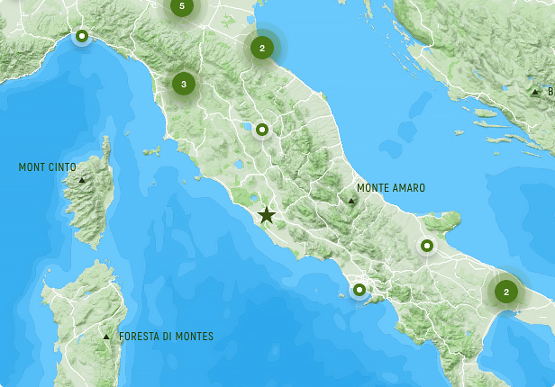
Overview
Treweler comes with a variety of cool features that are all well-organized, self-explaining and easy to use.
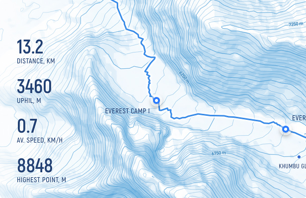
Demo Map
- Integration with Mapbox and support for its great customization settings.
- Display full-screen maps using any WordPress page.
- Publish your map in any place using shortcode functionality and settings.
Map Styles
As far as this feature goes, it includes several built-in map styles, so you can easily choose a style that you like or the one that suits your project goals.
When it comes to custom map styles, they are a powerful tool that breathe life into your ideas. To make things easier for you, we have prepared several custom styles, so that you only copy them to your account and use them for your projects.
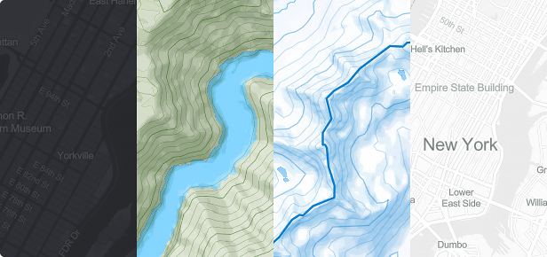
The plugins allow you to add custom map styles created in the Mapbox Studio style editor or copied from other sources.
Map Features
Maps are the basis for realizing your ideas and shaping them accordingly.
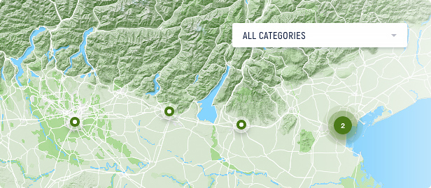
- Create and manage any number of maps in a few clicks.
- Setting the display of standard map controls such as Distance Scale, Fullscreen, Search and Zoom & Pan.
- Great choice of pre-installed maps, along with the ability to create your own style using Mapbox Design Studio.
- The initial geographical center, zoom level and the zoom range of your map.
- The ability automatically display the user’s current location at the initial map loading.
- The “Geolocation” control to manually obtain the user’s current location.
- Add a personal touch to your map by adding a title, description, and a customer’s logo.
- Group Markers and Routes together using categories and related functionality.
- Manage two types of attributes required by Mapbox.
- Enable marker clusters to display a large number of markers on your map.
- Change the language of your map labels for some map styles.
- Place additional information or interesting facts on the map, using Information widgets.
- Enable the initial pitch and bearing of your map.
- Use a progress preloader with logo and text information that will appear once the entire map is loaded.
- Impressively switch between markers using one of the animation types, Jump or Fly.
Markers & Popups
Markers and popups are the most important elements of the maps. The settings for these elements include a lot of different options.
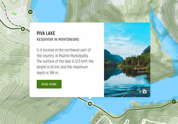
Demo Map
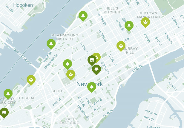
Demo Map
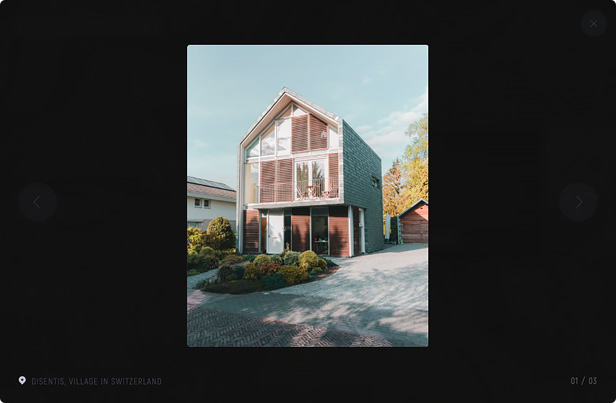
Demo Map
- Add any number of markers to your maps.
- Ability to add a marker to multiple maps.
- Quickly find a place for the marker, just using the search textbox.
- Great choice of built-in marker styles, with any color, and for any purpose.
- Google Material icons support.
- Lightbox image gallery.
- Marker templates builder.
- Custom fields builder.
- Enable marker popups and customize their styles and behavior.
- Ability to add your own custom markers in any graphic format.
Marker Templates Builder
Making a large number of markers in the same style is made so convenient by creating a marker template with your chosen marker style, popup and image settings, text labels, and custom fields settings. Just select the template name in the marker settings to instantly apply it to a marker. You can also change any marker setting while keeping the rest of the template settings.
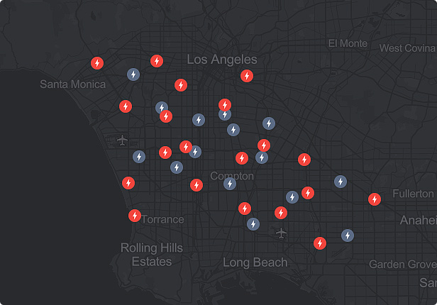
Demo Map
Store Locator
Use the Store Locator to display map markers within the user’s vicinity, or in the vicinity of the area on the map that the user chooses. The user’s position can be determined automatically, or set manually by clicking on the map, or by using an intuitive address search with auto-completion. The number of displayed markers can be sorted by distance, either in kilometers or miles.
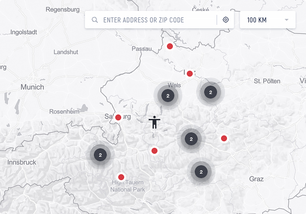
Demo Map
- Automatic user geolocation.
- Custom styles for the geolocation marker.
- Option to show only necessary controls on the map (address search, automatic geolocation icon, sort by distance).
- Option to place controls in a preferred corner of the map.
- Sorting locations by distance.
- Custom values for sorting by distance.
- Setting default value for sorting by distance.
- Setting distance sorting in either kilometers or miles.
- Intuitive address search with auto-completion.
Custom Fields Builder
Create your own Custom Fields that appear in marker popups and expand the standard information about the specific location. Using the custom fields builder, you can easily control the types of custom fields, edit their text information, and change their order in the popup.
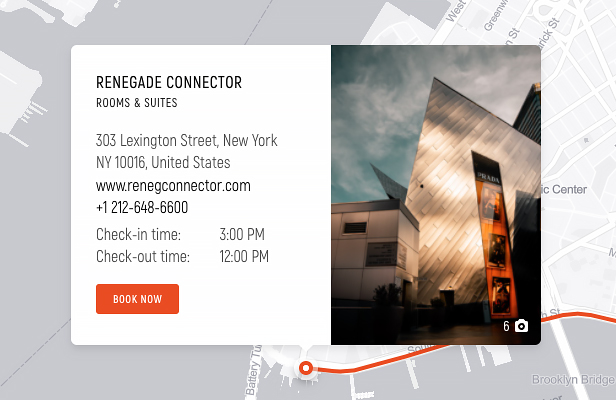
Demo Map
Tours
Make a map more interactive and engaging by choosing virtual tour settings. Using the virtual tour builder options that allow users to switch between markers and areas (i.e. set it for jumping, flying, zooming, speed, curve, pitch, bearing, etc.), you can make the world map navigation experience more interesting and informative.
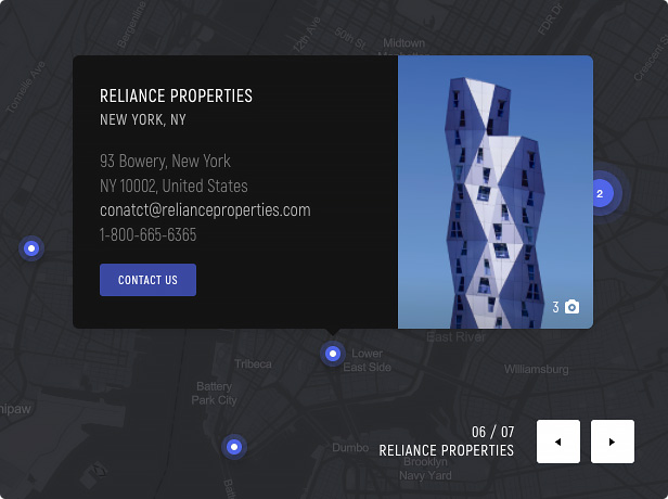
Demo Map
Routes
Create any number of routes and change their style to best fit your map route planner. Select between the free route drawing mode or one of the available matching modes (driving, walking/running, cycling) to build the custom route and guide the viewer in navigating.
Switch to WordPress GPX viewer mode if drawing the route is not suitable. Treweler gives the option to import a route in GPX file format. This will complete your map with accurate route data that is available on your GPS device or from any third-party resources.
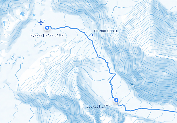
Demo Map
- The ability to manage any number of routes and their styles.
- Draw a route using the draw tools and route match functionality.
- Just simply import the GPX file if the route drawing is not suitable for you.
- Change the style of the route lines using various settings.
- Ability to add a route to multiple maps.
Shapes & Drawing Tools
Make maps more visually attractive and informative by drawing various shapes. Using versatile drawing tools that draw lines, polygons, circles, and bezier curves, grab users’ attention to certain areas and objects on the map. Customize any shape imaginable and choose from a large selection of style settings.
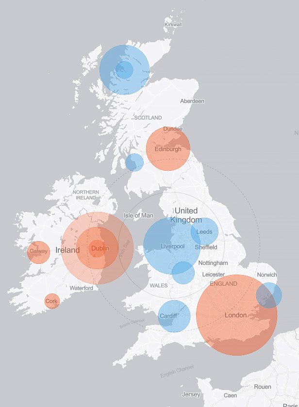
Circle Drawing Tool Demo Map
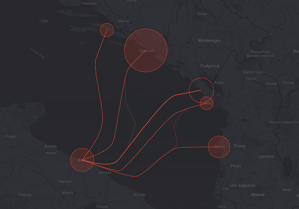
Bezier Curves Drawing Tool Demo Map
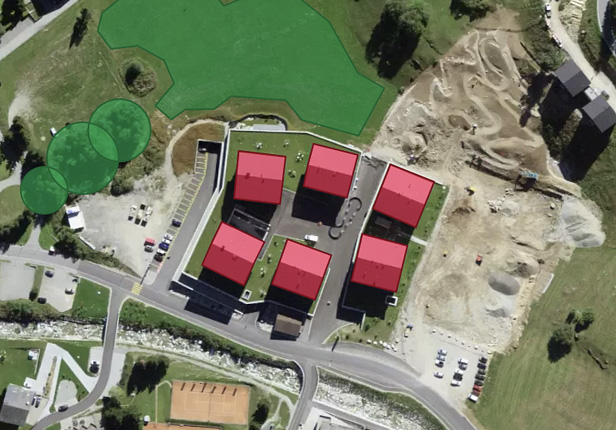
Polygon Drawing Tool Demo Map
- Add any number of shapes to your maps.
- Add a shape to multiple maps.
- Add lines by using the Line tool.
- Add other varieties of shapes using the Polygon tool.
- Add circles with the Circle tool.
- Use the Bezier tool to draw and edit bezier curves.
- Change the style of the shapes using various settings.
Credits
- Mapbox
- Bootstrap
- jQuery
- Fontfabric Akrobat Font
- Select2
- Color Picker
- FontIconPicker
- Fancybox
Changelog
## [1.10] - 10-05-2022
### Added
- Shapes & Drawing Tools.
- Mapbox GL JS 2.8.2 version support.
### Fixed
- The "Settings" link issue on the WordPress "Plugins" page.

## [1.09] - 11-03-2022
### Added
- Map Store Locator.
- Ability to add a route to multiple maps.
### Fixed
- Bootstrap conflict for some WordPress themes.
- GPX file uploader conflict with the Revolution Slider plugin.
- Map clustering stops working when the marker text label field is empty.

## [1.08] - 15-02-2022
### Added
- Mapbox GL JS 2.7 version support.
- Ability to add a marker to multiple maps.
### Fixed
- WordPress user roles issue.
- Blurring map elements, for maps inserted using a shortcode.
- Changing the logo size after adding widgets.

## [1.07] - 27-01-2022
### Fixed
- Errors in marker settings when using templates.
- Displaying the logo of the map and preloader.

## [1.06] - 24-01-2022
### Added
- Marker templates.
### Fixed
- Minor code fixes and improvements.

## [1.05] - 29-12-2021
### Added
- The "Additional CSS" field for adding custom CSS code.
- Position settings for map controls.
- New "Geolocation" control to manually obtain the user's current location.
- The ability automatically obtain the user's current location at the initial map loading.
- Manually adding and removing custom fields on the marker settings page.
- Default values for custom fields.
### Changed
- Plugin main settings page layout.
- Map controls settings moved to the "Controls" tab on the map setting page.
### Fixed
- Scrolling pages issue in the "Salient" theme.
- Icons preview issue for the icon-pickers.

## [1.04] - 16-12-2021
### Added
- Custom fields builder.
### Fixed
- Lightbox gallery issue with a single image.

## [1.03] - 02-12-2021
### Added
- Lightbox image gallery for markers.
- Link settings for the map logo.
- Mapbox GL JS 2.6.1 version support.
### Changed
- The active tab is not reset after clicking on the "Publish" or "Update" buttons in the admin panel.
- Plugin icon in the WordPress admin menu.
- The minimum width of the container for the widget text description.
### Fixed
- 404 error issue for maps embedded via shortcode.
- Displaying markers on the map if they belong to more than one category.
- Translation of text placeholders for the category drop-down list.
- Z-index for the category drop-down list.
- Right-margin issue for the widget text descriptions.

## [1.02] - 18-11-2021
### Added
- Google Material icons for "Dot" and "Balloon" markers.
### Changed
- Custom marker settings moved to the "Marker Styles" settings group.
- The layout of settings for "Balloon" markers.
- Color-pickers and icon-pickers now open upwards.
### Fixed
- Flickering of halo when hovering over "Point" markers.

## [1.01] - 09-11-2021
### Fixed
- Overlapping of elements with clusters.
- Minor code fixes and improvements.

## [1.00] - 09-11-2021
### Initial Release
Source



Reviews
There are no reviews yet.